LI
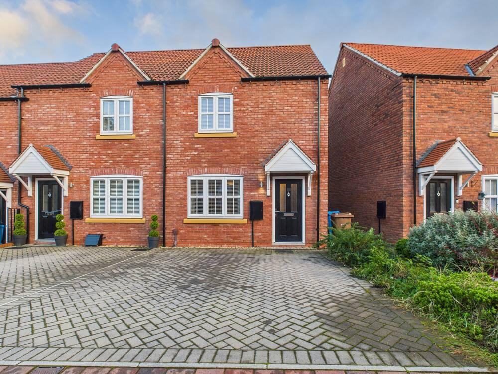
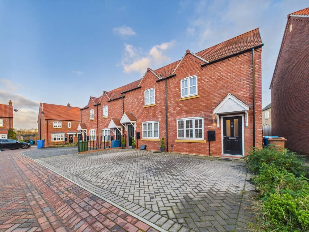
Sanderson Drive, Hessle, HU13 0FZ
By Lime Property
£ 155,000
Lime Property says ..
Discounted Hessle Home
- Bedrooms
- 2
- Bathrooms
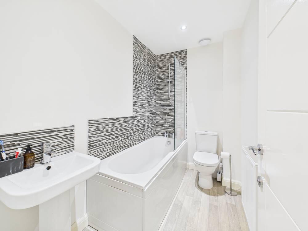
- 1
The heatmap indicates the level of crime in the area. The color of the heatmap indicates the crime severity and recency.
Metrics Year-on-Year
- Average area value
- 248,204.00 £Increased by 8.18 %
- Average area rental value
- 961.00 £/moIncreased by 12.27 %
- Est rental Yield
- 4.65 %Increased by 3.79 %
- Crime Rate
- 2.00 %Unchanged by 0.00 %
from 229,445.00 £
from 856.00 £/mo
from 4.48 %
from 2.00 %
Agent Activity
Lime Property created the listing.
Nearby Schools
| Name | Type | Ofsted | Distance |
|---|---|---|---|
| Hessle Mount School | Other Independent School | Inadequate | 0.58 KM |
| Hessle High School And Penshurst Primary School | Academy Converter | Good | 0.97 KM |
| Tranby | Other Independent School | 1.13 KM | |
| All Saints Church Of England Infant Academy | Academy Converter | 1.81 KM | |
| All Saints Church Of England Junior Academy | Academy Converter | 1.81 KM |
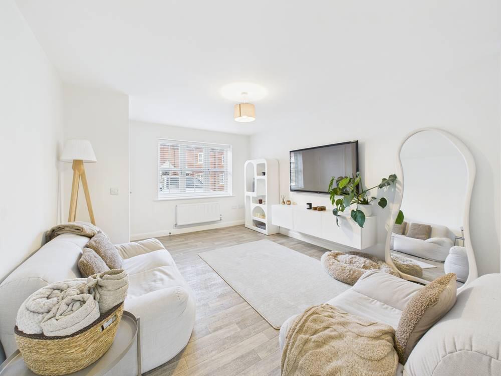
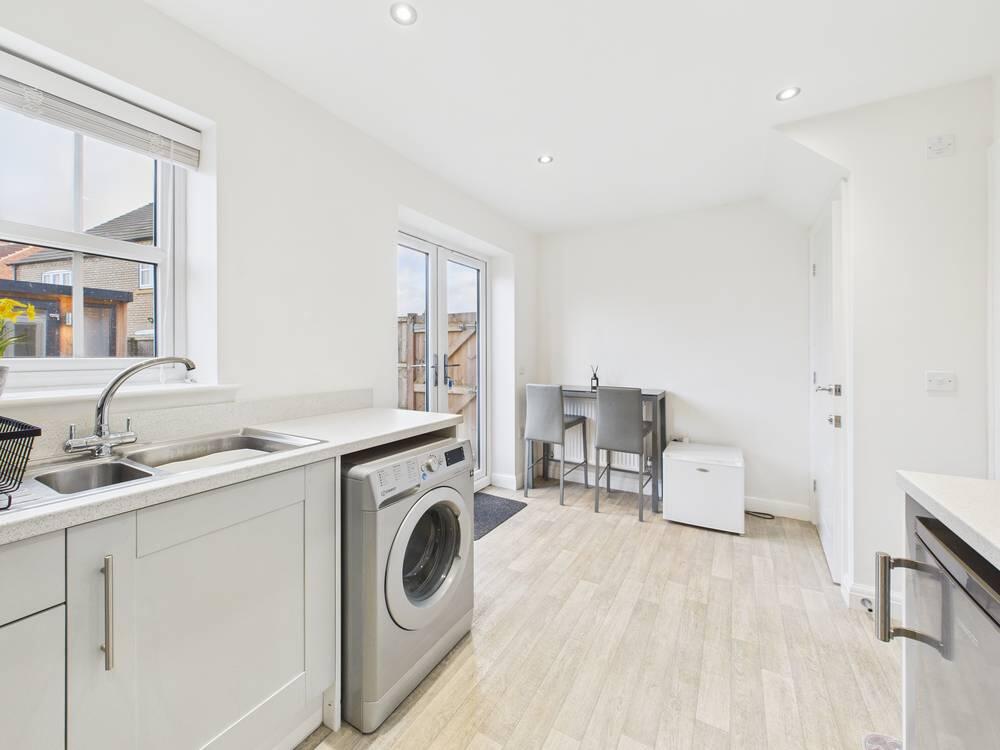
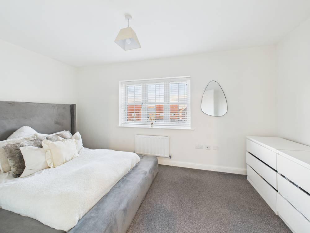
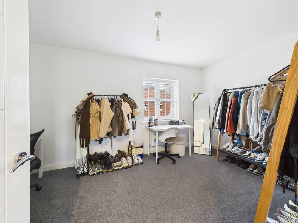
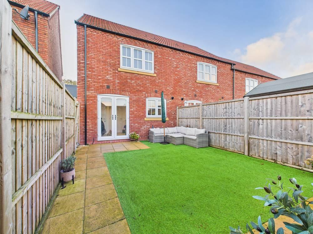
Images


Nearby Streets
| Name | Average Price | Average Sqft | Distance |
|---|---|---|---|
| Sanderson Drive | £ 300,000 | 0 | 0.00 KM |
| The Circle | £ 0 | 0 | 0.00 KM |
| Ash Close | £ 325,000 | 0 | 0.00 KM |
| Park Row | £ 0 | 0 | 0.00 KM |
| A15 | £ 0 | 0 | 0.00 KM |
Nearby Transport
| Name | NLC | TLC | Distance |
|---|---|---|---|
| Hessle | 8067 | HES | 1.51 KM |
| Barton-On-Humber | 6207 | BAU | 4.63 KM |
| Barrow Haven | 6212 | BAV | 6.89 KM |
| Ferriby | 8061 | FRY | 7.03 KM |
| Cottingham | 8056 | CGM | 7.16 KM |
Nearby Listings
| Address | Price | Type | Score | Distance |
|---|---|---|---|---|
| Sanderson Drive, Hessle, HU13 0FZ | £ 155,000 | BUY | Unknown | 0.00 KM |
| Sanderson Drive, Hessle | £ 149,500 | BUY | Unknown | 0.03 KM |
| Karrina Close, Hessle | £ 389,950 | BUY | 7 / 10 | 0.14 KM |
| Boothferry Road, Hessle, HU13 0NQ | £ 180,000 | BUY | Unknown | 0.17 KM |
| Holly Drive, Hessle | £ 385,000 | BUY | 8 / 10 | 0.19 KM |
Nearby Properties
| Address | Price | Distance |
|---|---|---|
| 366 Boothferry Road | £ 265,000 | 0.12 KM |
| 362 Boothferry Road | £ 278,250 | 0.12 KM |
| 287 Boothferry Road | £ 159,250 | 0.20 KM |
| 267 Boothferry Road | £ 150,000 | 0.20 KM |
| 291 Boothferry Road | £ 167,950 | 0.20 KM |